Kevin Barton: Landscape & Geophysical Services
|
How can archaeological remote sensing be used by schools and local community and heritage groups? |
Kevin has over 25 years experience in managing and conducting geophysical surveys in Ireland and overseas. He and his team specialise in services such as LiDAR processing, visualisation and interpretation, vertical electric sounding (VES), electrical resistivity tomography (ERT) and ground penetrating radar (GPR) which are all necessary for the assessment of environmental, geological and heritage resources. Training, research and development services play a large part in what is offered to communities, the public, commercial companies and academic organisations.
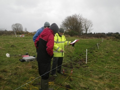
Last year, Kevin focused on the his work with the Transition Year students of Balla Secondary School in order to bring the discipline of archaeology to the classroom. Kevin intended to access the students capability through both indoor and outdoor exposure to the techniques and allowing them to witness the environment within which the humanities and our heritage are being threatened. Kevin spoke on an innovative approach to Remote Sensing and its applications in inspiring the next generation of archaeologists.
For more information on Kevin Barton & his work, check out the link: http://www.lgs.ie/