Kevin Barton
Landscape & Geophysical Services
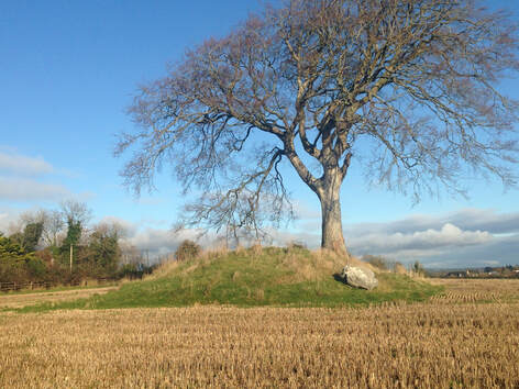
Rathcoon Mound, Co Meath (photo: Justin Kenny)
Bumps and mounds in the landscape – Some geophysical tools that can aid their classification.
Within the Irish landscape archaeological monuments are found in terrains ranging from generally flat-lying to complex with irregular topography. Known and unknown bumps and mounds of possible archaeological scale are found within these terrains. Discounting geological features, and in the absence of excavation, the morphology of these mounds is often used to classify them in type, function and time. Questions can arise on the classification and there is a need to find further evidence which often involves questions about the internal structure of the mound. Geophysical surveys can aid the investigation of bumps and mounds by revealing their internal structure and/or what they may contain. This presentation will review geophysical signatures of a bump and some mounds of different size and topographic profile. These will include a bump in LiDAR topography, a shell midden, a ringfort with souterrain and a barrow.
Kevin is an archaeological geophysicist. He was Co-Director of the Heritage Council-funded ArchaeoGeophysical Imaging Project in the Rathcroghan Complex which carried out Ireland’s first multi-method remote sensing survey in the 1990s. A career break from University College Galway led to the foundation of LGS (Landscape & Geophysical Services). In Ireland and mainland Europe he has surveyed over 100 sites dating from the Neolithic to the 1940’s. He was a member of the General Management Board of the EU-funded ArchaeoLandscapes Europe (ArcLand) Project. Within ArcLand he was the Co-Director of ground and aerial photography field schools in Ireland and Hungary. With ArcLand support, Kevin has pioneered real hands-on local community engagement in remote sensing in Ireland. Current projects in Ireland include work with heritage groups and local museums. Current European work includes collaboration with former ArcLand partners on the Hidden Cultural Landscapes of the Western Lesser Poland Upland Project.
Kevin is an archaeological geophysicist. He was Co-Director of the Heritage Council-funded ArchaeoGeophysical Imaging Project in the Rathcroghan Complex which carried out Ireland’s first multi-method remote sensing survey in the 1990s. A career break from University College Galway led to the foundation of LGS (Landscape & Geophysical Services). In Ireland and mainland Europe he has surveyed over 100 sites dating from the Neolithic to the 1940’s. He was a member of the General Management Board of the EU-funded ArchaeoLandscapes Europe (ArcLand) Project. Within ArcLand he was the Co-Director of ground and aerial photography field schools in Ireland and Hungary. With ArcLand support, Kevin has pioneered real hands-on local community engagement in remote sensing in Ireland. Current projects in Ireland include work with heritage groups and local museums. Current European work includes collaboration with former ArcLand partners on the Hidden Cultural Landscapes of the Western Lesser Poland Upland Project.