Robert Loughran (Bluesky International Ltd.)
Shining a laser over the past
|
|
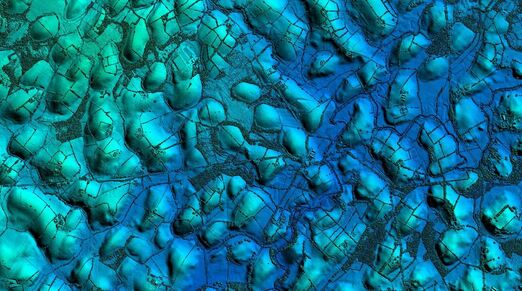
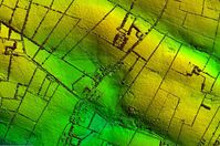
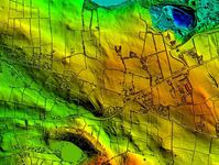
The talk will consider the application of aerial LiDAR and imagery capture in the context of archaeological assessment. We will review some recent examples of LiDAR data and aerial photography acquired in Ireland with a specific focus on ‘hidden’ archaeology. Emphasis will be given on how LiDAR projects are planned, implemented and delivered using best practice in an Irish context. Consideration will be given to the relevant technical and mandatory aspects of data acquisition. Project examples will be provided together with an indication of costs to acquire different sized areas using an array of sensors fitted on both fixed wing and UAV LiDAR systems.
Robert Loughran has over 25 years’ experience in the Geospatial industry having worked with several of the world’s largest and most esteemed providers of aerial survey services. In recent years, Robert has been responsible for developing Bluesky’s products and services on the island of Ireland specifically aerial LIDAR and photography and associated mapping products.